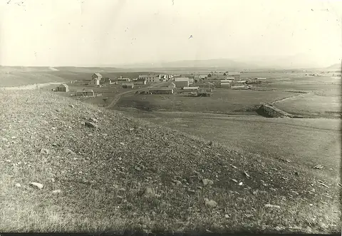
Emmet Ghost Town
Union County, South Dakota42.9525, -96.7431
Can you visit?
Private land, lived-in town
Private or unlisted land · Streets public, lots private
- Nearest town
- 9 miBeresford, SD
- Mild months
- Apr–Oct7 of 12
- Elevation
- 1,300 ft396 m

Emmet sits in Union County, South Dakota. People call it a ghost town, though 257 residents were counted in 2000. It lies at about 1,300 feet above sea level.
On the map
- Private or unlisted
Star: Emmet. Dots: other ghost towns within 40 miles, colored by land manager. Squares: towns over 1,000 people. Rings are straight-line distance. Live map: © OpenFreeMap, OpenMapTiles, OpenStreetMap contributors.
The closest town with more than 1,000 people is Beresford, SD, about 9 miles north in a straight line. The nearest city over 50,000 is Sioux City, IA, 36 miles away.
Ghost towns nearby
- Hooker22 mi northwest
- Stevens32 mi southeast
- Covington36 mi southeast
- Lakewood40 mi northeast
- East Sioux Falls40 mi north
- Dodds43 mi southeast
- Bruce43 mi northeast
- Manley47 mi north
Distances are straight lines. Roads to ruins are often dirt, and a 20-mile hop can take an hour.
Who owns the land
Private or unlisted land
The town center is not on any public or protected parcel in PAD-US, the national map of public land. People still live here, so streets are open while buildings and lots belong to their owners. Ask before you step onto a property.
The point is the town location from Wikidata, and the land record is from PAD-US 3.0 (USGS). Ruins can spread past that point, and land changes hands faster than the database. How we read PAD-US.
Weather by month
Mild months here run April to October, judging by NOAA normals from Centerville 6 Se. Snow is normal from November to April.
NOAA 1991–2020 normals from the Centerville 6 Se station (USC00391579), 10 miles away. About 26.8 inches of precipitation a year.
Facts
| Location | Union County, South Dakota |
|---|---|
| Coordinates | 42.95250, -96.74306 |
| Elevation | 1,300 ft (396 m) |
| Census counts | 2000: 257 |
| Also known as | Emmet, South Dakota, Emmet, SD |
| Sources | Wikidata Q5373472 · Wikipedia article |
Questions
Where is Emmet ghost town?
In Union County, South Dakota, at 42.9525, -96.7431. The closest town with more than 1,000 people is Beresford, SD, about 9 miles north in a straight line. The nearest city over 50,000 is Sioux City, IA, 36 miles away.
Can you visit Emmet?
Private land, lived-in town. The town center is not on any public or protected parcel in PAD-US, the national map of public land. People still live here, so streets are open while buildings and lots belong to their owners. Ask before you step onto a property.
When is the best time to visit Emmet?
Mild months here run April to October, judging by NOAA normals from Centerville 6 Se. Snow is normal from November to April.
Are there other ghost towns near Emmet?
Yes. Hooker (22 mi), Stevens (32 mi), Covington (36 mi), Lakewood (40 mi).